
Forestry
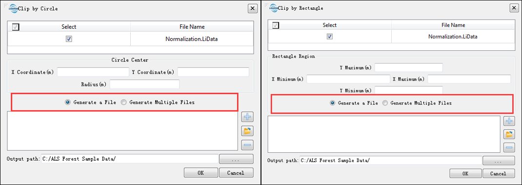
Is it possible to save each sample as a separate file when cutting the point cloud data by center and radius?
The results of Clip by Circle and Clip by Rectangle can be saved as multiple files or merged into a single file. The user can choose either one as an option.
Can LiPowerline generate CHM in batches?
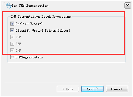
LiPowerline can generate CHM in batches (ALS Forest > Batch Process > For CHM Segmentation).
How to evaluate the accuracy of individual tree segmentation results?
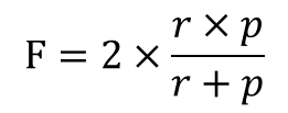
For evaluation of individual tree segmentation accuracy, please refer to Li et al's article on (Li et al., 2012). By comparing with field measurement, the number of correctly segmented trees, the number of falsely segmented trees, and the number of missed trees are calculated according to the following formulae: recall (r), precision (p), and F-score (F). Recall indicates the tree detection rate, precision indicates the correctness of the detected trees, and F-score is the overall accuracy taking both commission and omission errors into consideration. The values of r, p and F vary from 0 to 1.
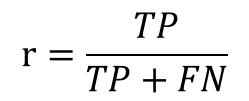
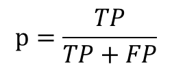
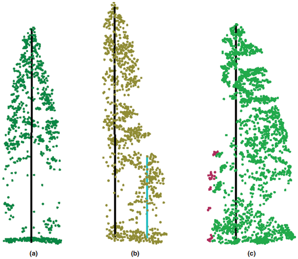
(a) Correctly detected tree (True Positive, TP)(b)undetected tree (False Negative, FN) (c)falsely detected tree(False Positive, FP)
What parameters affect the CHM segmentation accuracy and how should these parameters be set?
- The accuracy of CHM segmentation are affected by CHM resolution and Gaussian smoothing factor.
- CHM is the difference between DSM and DEM. The CHM resolution is determined by the resolution of DSM and DEM. Generally speaking, this value should not exceed one-third of the crown width, and the range can be set to 0.3-1m. Usually, the resolution of 0.5-0.6m can get a higher segmentation accuracy.
- Sigma is the Gaussian smoothing factor (default value is "1"). The greater the value is, the smoother the results are. The degree of smoothness can affect the number of trees being segmented. In the case of under-segmentation, it is recommended to reduce this value (e.g. 0.5); and in the case of over-segmentation, it is recommended to increase the value (e.g. 1.5).
- Moreover, beside the algorithm parameters, the CHM segmentation result can also be largely influenced by tree density and tree species. If the algorithm does not work well in s certain study area, users can try to use other segmentation algorithms to get the best segmentation result.
How to remove some results with small crown area after running CHM segmentation?
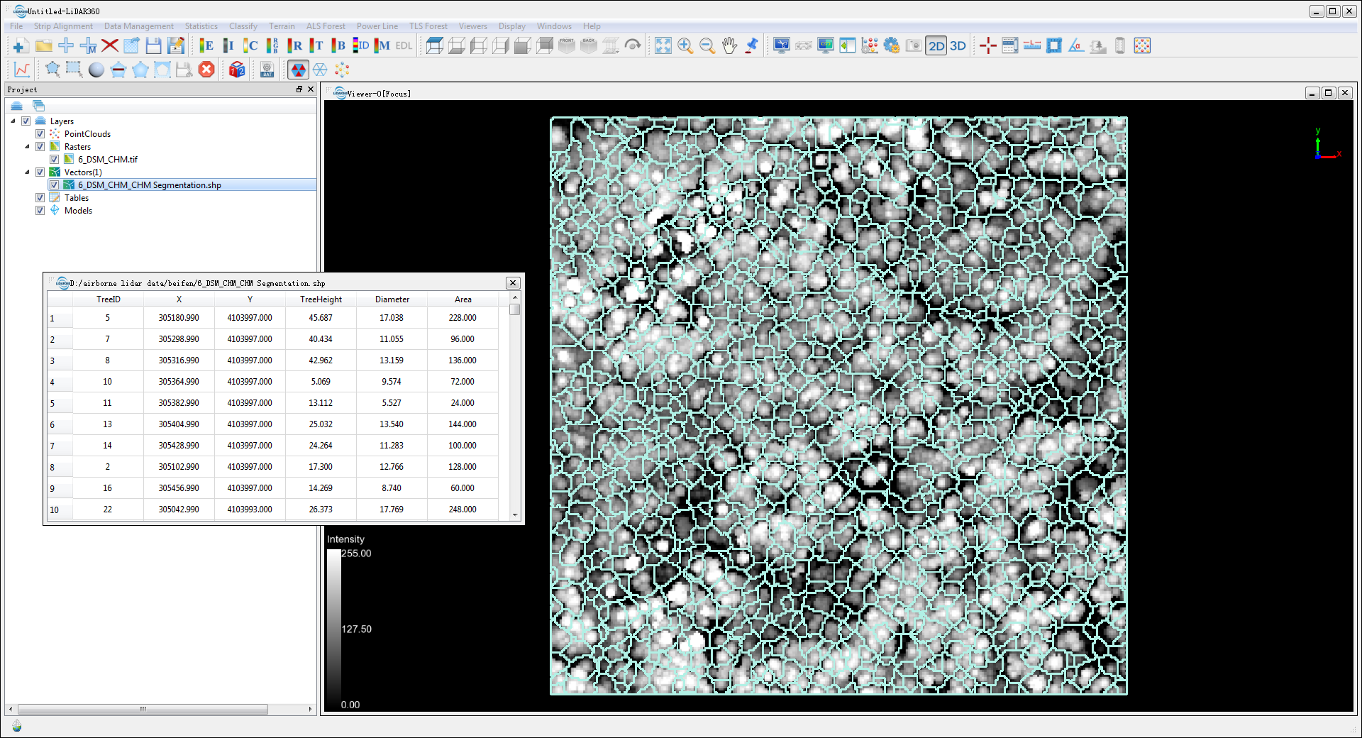
After running CHM segmentation, a shp file containing the tree boundary is obtained. The attribute table includes the ID, location, height, crown diameter and crown area of each tree. The data can be imported into a third-party software (e.g. ArcGIS), and you can remove the segmentation results with a small crown area according to the crown area attribute.
How to make point cloud data below 2m be participated in segmentation?
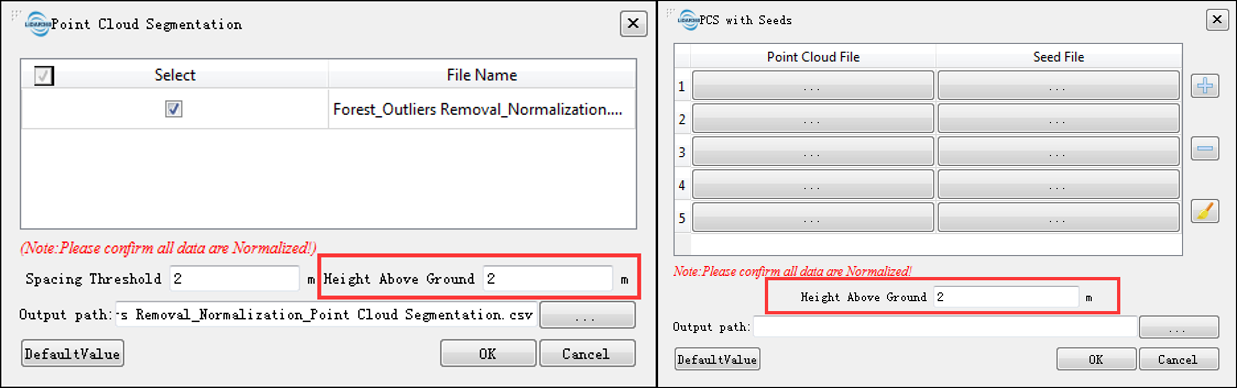
The parameter "Height Above Ground" on the Point Cloud Segmentation and PCS with Seeds interfaces indicate that points below the value are not considered as part of the tree and will be ignored during the segmentation process. The default value is 2m. If you need to make the point cloud below 2m participate in the segmentation, the value can be reduced appropriately.
Which kind of segmentation method for coniferous and broad-leaved mixed forest data can be used to obtain higher accuracy?
- For coniferous and broad-leaved mixed forest data, CHM Segmentation is recommended.
The growth of trees in the area is not the same, how to achieve higher segmentation accuracy?
- It is recommended to clip the point cloud according to the growth as different data by Select Tools or Clip Tools and handle them separately.
How to export individual tree segmentation results to third-party software for analysis?
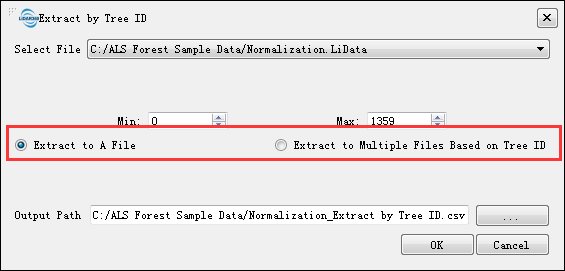
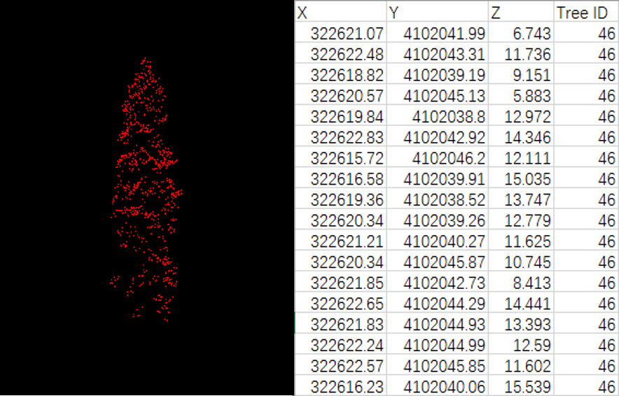
Click ALS Forest > Extract by Tree ID, the segmented point cloud can be exported to CSV file for subsequent analysis using other software. LiPowerline supports exporting each tree as a separate CSV file or exporting all points as one file. The exported CSV file is shown in the figure below, which contains X, Y, Z coordinates and tree ID information.
How many sample data files are required for regression analysis?
- The number of sample data used for regression analysis is not clearly defined. In general, under the premise of ensuring the accuracy of plot location and measurement, the greater the number of sample data is, the higher the accuracy of regression analysis can achieve. Sample sites should be randomly selected and representative to cover different forest types within the study area. A sample size less than 30 is referred as a small sample, and a sample size of 30 or greater is referred as a large sample. To ensure regression analysis accuracy, the recommended sample size should be greater than or equal to 30 (you should also consider the size and complexity of the study area).
How to choose the independent variables involved in the regression analysis?
- The elevation percentiles obtained from LiDAR data are generally the independent variables for regression analysis. However, specific elevation percentiles are not all the same for different study areas. It is recommended that the stepwise regression analysis should be used for automatic selection of parameter variables to achieve the optimized regression model.
Can trained regression models be used for other data?
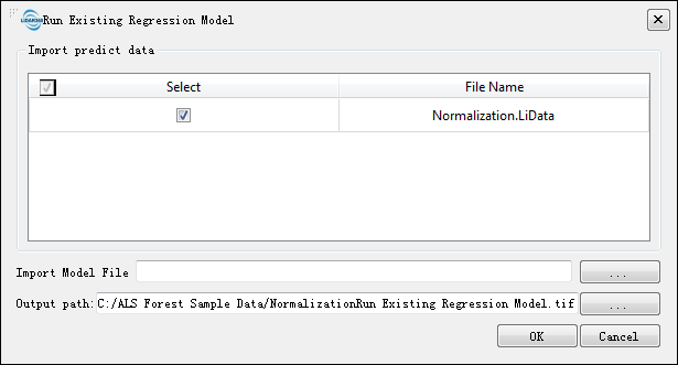
Yes. Click ALS Forest > Regression > Run Existing Regression Model. Available regression models (Linear Regression, Support Vector Machine and Fast Artificial Neural Network) can be used to estimate forest metrics.
Can I export the independent variables (e.g. elevation percentiles) generated by LiPowerline into third-party software (e.g. SPSS, R) for regression analysis?
- Yes. Independent variables provided by LiPowerline including Elevation Percentile, Elevation Density, Intensity Percentile, Leaf Area Index, Canopy Cover and Gap Fraction. Among them, Elevation Percentile, Elevation Density and Intensity Percentile are in CSV formats, and they can be imported into third-party software such as SPSS directly. Leaf Area Index, Canopy Cover, and Gap Fraction are in TIF formats that can be converted to text format by ArcGIS and imported into third-party software.
	@inproceedings{
	    author={ Li W K, Guo Q H, Jakubowski M K and Kelly M},
	    title={A new method for segmentation individual trees from the LiDAR point cloud},
	    booktitle={ Photogrammetric Engineering and Remote Sensing,78(1):75-84},
	    year={2012}
	}