
Measurement
On the Measure page, select coordinate, distance or area measurement. Select the dataset and zoom in until the target can be identified clearly before placing points.
Coordinates
Select Coordinate and click a location to read its coordinates. Coordinates use the current scene space. Data without coordinate-system calibration should not be treated directly as geographic coordinates.
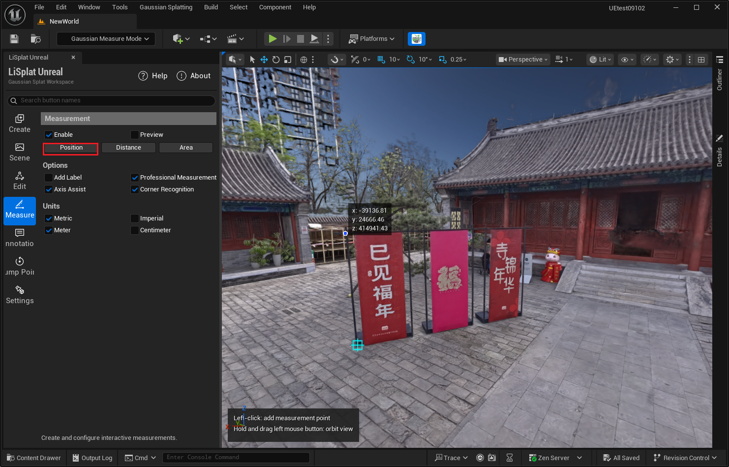 Figure: Coordinate measurement
Distance
- Select Distance and click the start point.
- Click subsequent points to display segment distances and the current result.
- Double-click or press Enter to finish. Right-click or press Backspace to remove the last point. Press Esc to cancel the current drawing.
Enable Professional Measurement to show signed X, Y and Z offsets, making horizontal and vertical changes easier to distinguish.
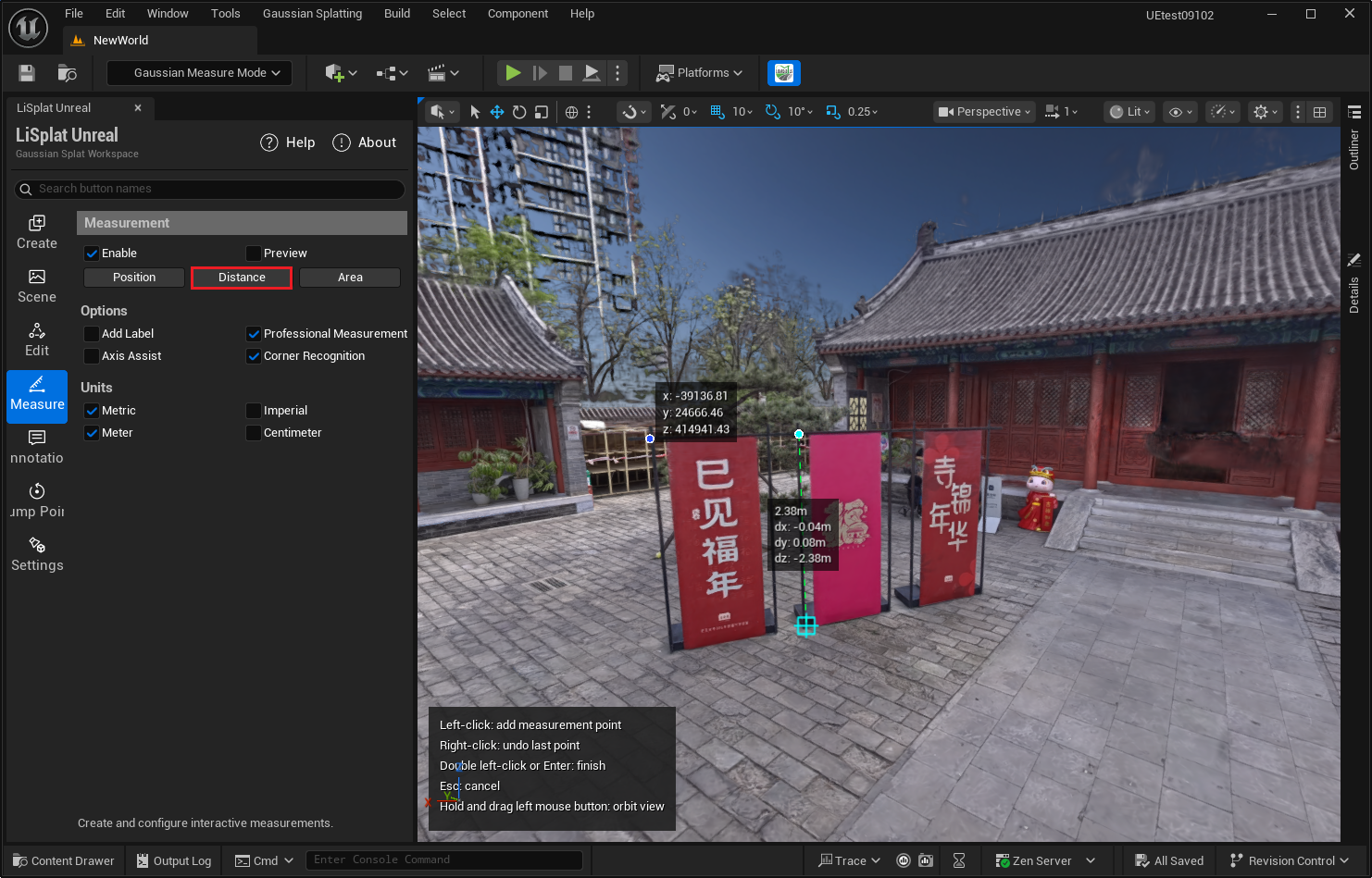 Figure: Distance and component measurements
Area
- Select Area and place points in boundary order, using at least three non-collinear points.
- Double-click or press Enter to close the boundary and display the area.
- If a point is wrong, right-click or press Backspace, then place it again.
Avoid self-intersecting polygons. A few boundary points are insufficient to determine the actual surface area of a complex surface spanning different heights.
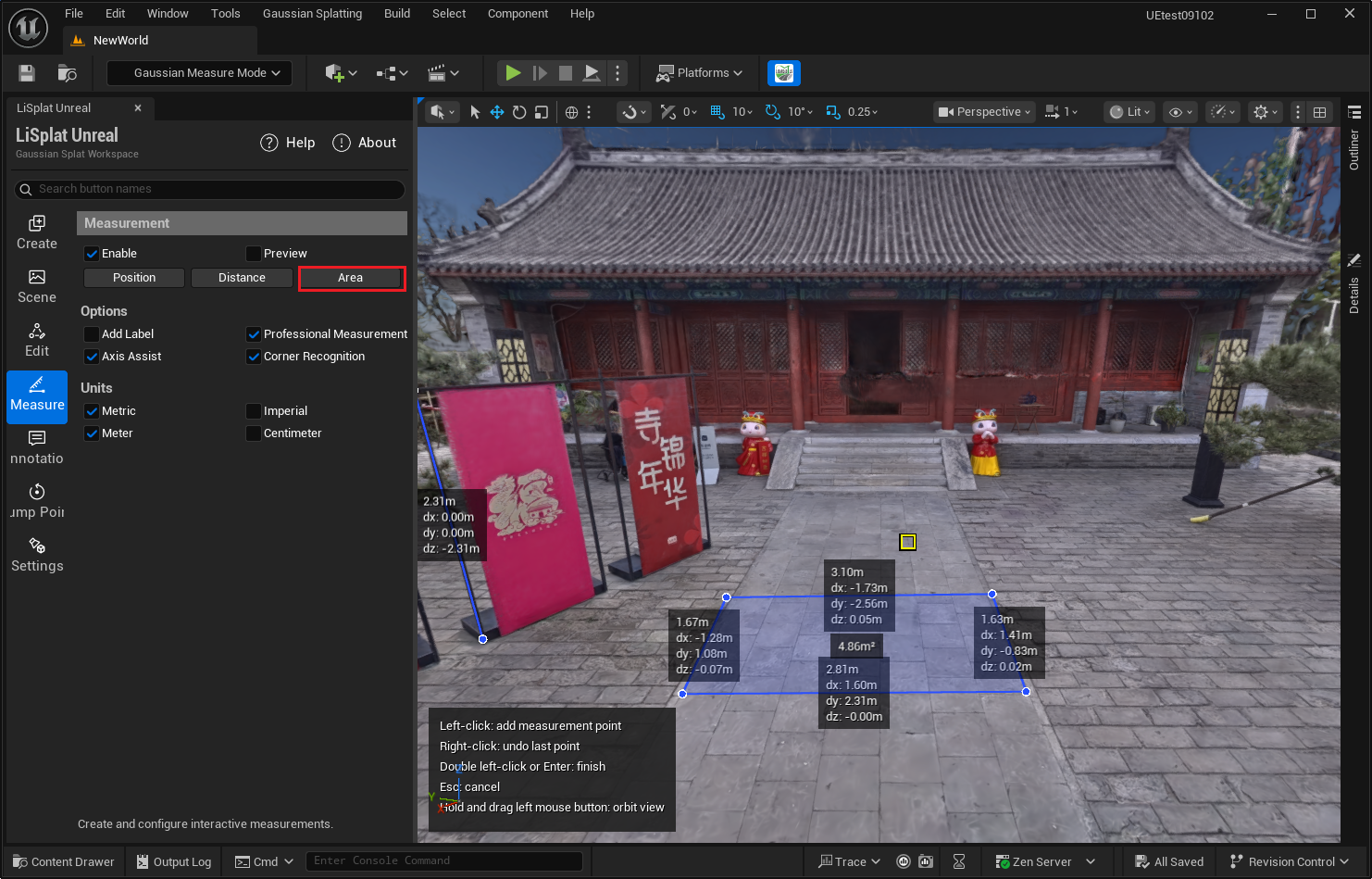 Figure: Polygon area measurement
Point Assistance and Units
| Setting | Usage |
|---|---|
| Axis Assist | Assists axis-aligned point placement for distance and area measurements; Ctrl toggles it |
| Corner Recognition | Assists corner detection; Tab toggles it |
| Units | Metric: m, cm, m² and cm². Imperial: ft, in, ft² and in² |
| Measurement Visibility / Enable | Controls visibility and interaction. Turning it off does not delete existing results |
| Only View | Displays results without hover editing controls |
Labels and Results
Move the pointer over a measurement result and click Add Label in its details to add a description. Use Delete to remove an unwanted result.