
Subsampling
Brief
Subsampling point clouds, namely, reducing the number of point clouds, LiPowerline offers three methods for resampling: minimum point spacing, sampling rate, and octree.
Usage
Click Data Management > Point Cloud Tools > Subsampling
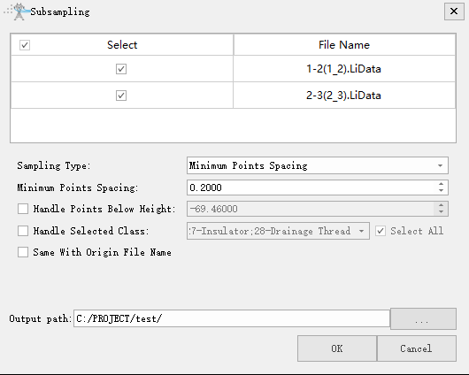
Settings
Input Data: The input file can be a single point cloud data file or multiple data files. File Format: *.LiData.
Sampling Type: This parameter defines the resampling method.
Minimum Points Spacing (default, default value is "0.2000"): Users need to set a minimum point spacing between two points so that the minimum three-dimensional distance between any two points in the sampled point cloud will not be less than this value. The larger the value is set, the fewer points will be kept.
Handle Points Below Height: If this item is checked, only points below that elevation are processed.
Handle Selected Class: If this item is checked, only the points of the target category are processed.
Same With Origin File Name: Whether to use the same file name of origin file name.
Output path: Path of the output file. New file will be generated after the algorithm being executed.