
Generate Point Cloud Data Collection Trajectory
Summary

Base on point cloud data, generate unmanned aerial vehicle (UAV) trajectory for airborne LiDAR equipment during field point cloud data collection .
Mode 1
Adjust the trajectory altitude based on the point cloud reference categories and generate single and double-sided trajectory based on the start and end towers.
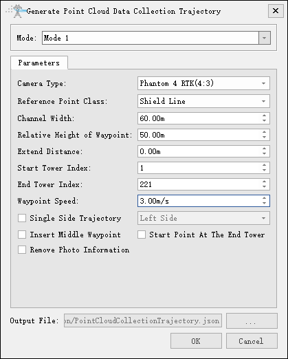
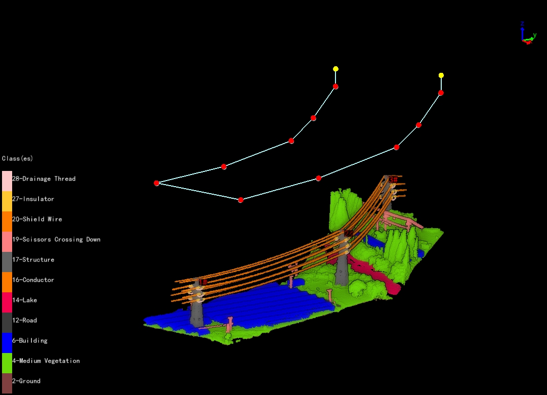
- Parameters:
- Camera Type: Select camera type for taking photos. Add a new camera type in the camera configuration.
- Reference Point Class: Optional shield wire, conductor, and ground.
- Channel width(m)(default value is "60.0"): Set point cloud channel width.
- Relative Height of Waypoint(m)(default value is "50.0"): The height of the waypoint relative to the reference point.
- Start Tower Index: Set the starting tower index, and generate the trajectory from the tower.
- End Tower Index: Set the end tower index, and generate the trajectory to the tower.
- Waypoint Speed(m/s)(default value is "3.0"): Set waypoint speed.
- Single Side Trajectory: If checked, you can choose the left and right sides; If unchecked, for both side trajectory.
- Insert Middle Waypoint: Add a waypoint in the middle of the tower.
- Start Point At The End Point: If checked, the starting and ending waypoints are both near the ending tower.
- Remove Photo Information: If checked, remove all camera information.
- Output File: Customize the trajectory path and name.
Mode 2
Adjust the trajectory altitude based on the point cloud reference category, enabling automatic generation of trajectories that cross upper and lower spanning lines. Meanwhile, the feasible tower intervals for flight can be calculated according to factors such as the UAV's flight time, and multiple trajectories can be automatically generated in the multi-route mode.
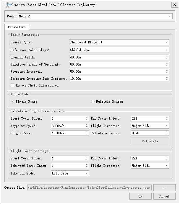
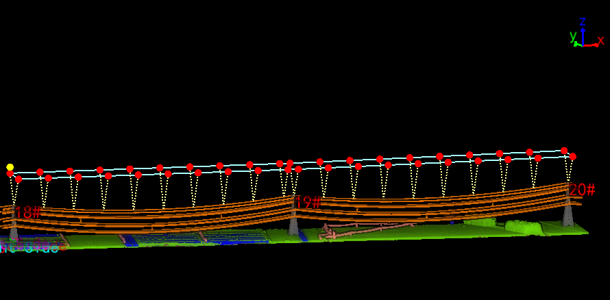
- Parameters:
- Base Parameters:
- Camera Type: Multiple types of drone cameras are available for selection.
- Reference Point Class: Optional shield wire and conductor.
- Channel Width(m)(Default value is "60.0"): The width between bilateral flight trajectories.
- Relative Height of Waypoints(m)(Default value is "50.0"): The height of waypoints relative to the reference point.
- Waypoint Interval(m)(Default value is "50.0"): Sets the distance between consecutive waypoints.
- Scissors Crossing Safe Distance(m)(Default value is "10.0"): The minimum height of the flight trajectory from point clouds of upper and lower crossing points. If lower than this height, the flight trajectory requires scissors crossing processing.
- Remove Photo Information: If checked, all photo information will be deleted.
- Route Mode:
- Single Route: Calculates the start and end towers for flight based on the Calculated Flight Tower Section, synchronizes updates to the Flight Tower Settings, and then computes a single flight trajectory according to the specific parameters in this window.
- Multiple Routes: Sets all towers to be inspected based on the Calculated Flight Tower Section, and plans multiple trajectories at one time according to the calculated maximum flight distance.
- Calculate Flight Tower Section: Can calculate the maximum flight distance of the trajectory. In single route mode, updates the Flight Tower Settings parameters; in multiple routes mode, multiple flight trajectories can be planned.
- Start Tower Index: Set the starting tower index.
- End Tower Index: Set the ending tower index.
- Waypoint Speed(m/s)(Default value is "3.0"): Setting range 0.01~99.99, rounded to two decimal places.
- Flight Direction: Sets the takeoff direction, optional large-number side and small-number side.
- Flight Time: Sets the maximum flight time of the drone.
- Calculate Factor: Sets the effective ratio of the maximum flight distance.
- Calculate: Automatically calculates the maximum flight distance and synchronously updates the flyable tower interval.
- Flight Tower Settings:
- Start Tower Index: Set the starting tower index.
- End Tower Index: Set the ending tower index.
- Take-off Tower Index: Sets the take-off tower number. A middle tower can be set for take-off, and the drone returns to the starting position after a full flight.
- Flight Direction: Sets the take-off direction, optional large-number side and small-number side.
- Take-off Side: Sets the left or right take-off position.
- Multiple Routes Parameter Settings:
- Take-off Side: Sets the left or right take-off position.
- Flight Direction: Sets the take-off direction, optional large-number side and small-number side.
- Output File: Customize the trajectory path and name.
- Base Parameters: