
Generate Distribution Network Tower Trajectory(Surround Method)
Summary

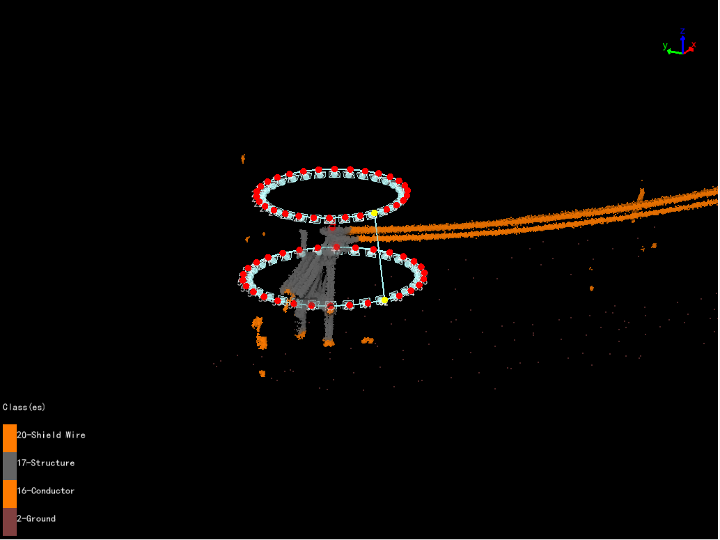
Automatically generate a circular trajectory with the tower marker point as the center. Take multi-directional and multi height photos of the tower.
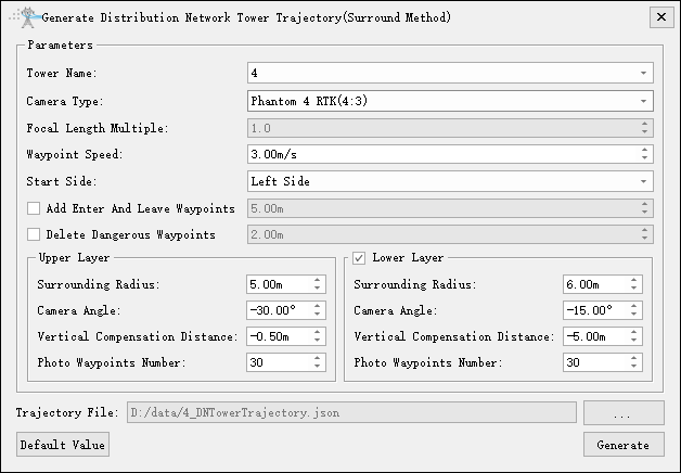
- Tower Name: Select the current tower name.
- Camera Type: Select camera type for taking photos. Add a new camera type in the camera configuration.
- Focal Length Multiple: Set camera focal length.
- Waypoint Speed(m/s)(default value is "3.0"): Set waypoint speed.
- Start Side(default value is "Left Side"): Waypoint shooting starting side.
- Add Enter And Leave Waypoints: Add two auxiliary points for entering and leaving the tower.
- Delete Dangerous Waypoints: Delete dangerous waypoints based on obstacle avoidance distance and point cloud data.
- Upper Layer
- Surround Radius(m)(default value is "5.0"): Horizontal distance from waypoint to tower marking point.
- Camera Angle(°)(default value is "-30.0"): Pitch angle from waypoint to target point.
- Vertical Compensation Distance(m)(default value is "-0.5"): Adjust the height of the target points for photography on the tower head. Positive value, the target point moves up. Negative value, the target point moves down.
- Photo Waypoint Number(default value is "30"): Generate a circular trajectory uniformly based on the "Photo Waypoint Number" in the current layer.
- Lower Layer: If checked, generate a two-layer circular trajectory.
- Surround Radius(m)(default value is "6.0"): Horizontal distance from waypoint to tower marking point.
- Camera Angle(°)( default value is "-15.0"): Pitch angle from waypoint to target point.
- Vertical Compensation Distance(m)(default value is "-7.0"): Adjust the height of the target points for photography on the tower head. Positive value, the target point moves up. Negative value, the target point moves down.
- Photo Waypoint Number(default value is "30"): Generate a circular trajectory uniformly based on the "Photo Waypoint Number" in the current layer.
- Default Value: Click "Default Value" to restore the initial parameters.