
KML of Tower
Summary
By reading the KML file and the tower position information in it, transform the coordinates to the current coordinate system. After modification of the tower location, export the information to LiTower file.
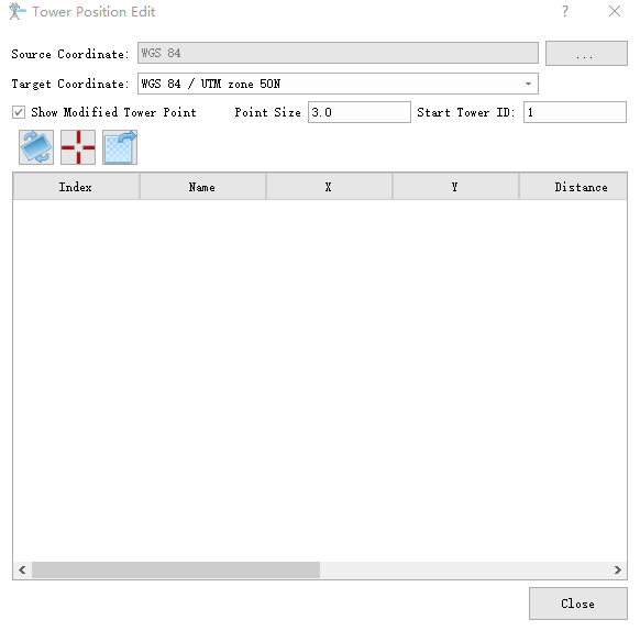
- Source Coordinate: The coordinate system of the KML file.
- Target Coordinate: The coordinate system of the point cloud.
- Show Modified Tower Point(selected by default): Show unedited towers in the window. Unchecked to hide unedited towers.
- Point Size(m)(default value is "3.0"): Set the radius of the sphere above the tower.
- Start Tower ID(default value is "1"): Set the index of the starting tower.
Transform Coordinate System

Transform the coordinates of the towers to the current coordinate system.
Select Point

Pick the position of towers in the current scene by clicking in the window. The software will automatically update location recorded in the tower information.
Export Tower File

Export the tower information in the current tower list to a LiTower file.
Note: When importing the KML file, only the coordinates and the name of the tower will be read, and the software will judge if the points are in the area of point cloud. Only the points located in the area of point cloud will be loaded into the project.