
DEM
Brief
A Digital Elevation Model (DEM) is a digitized simulation of the terrain derived from limited topographic elevation data—in other words, a digital representation of the terrain surface form. It represents ground elevation as an ordered numerical array and is a branch of the digital terrain model, from which all other terrain feature values can be derived.
Usage
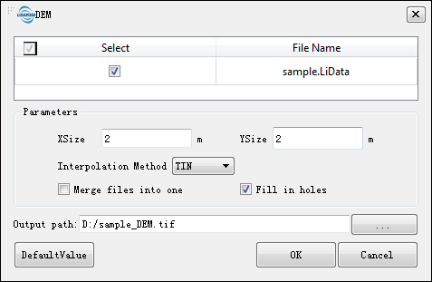
Before you can generate a digital elevation model, first classify ground point cloud. Click on the Terrain > DEM.
Settings
- Input Data:Make sure that each input point cloud data is a classified ground point; the input file can be a single point cloud data file or a point cloud dataset; The data to be processed must be already opened in LiPowerline software.
- Parameter Settings
- XSize(m)(default value is "2"):Set the X size of the grid.
- YSize(m)(default value is "2"):Set the Y size of the grid.
- Interpolation Method:Select an interpolation method, including IDW (Inverse Distance Weight) interpolation, Kriging interpolation, and TIN (Triangulated Irregular Network) interpolation.
- Power(default value is "2"):Set the power value; it is only available when the IDW interpolation method is selected.
- Merge Files into One:Not checked by default; check it to merge all generated raster files into one file.
- Fill in Holes:Checked by default; uncheck it to disable this function.
- Output Path:Save DEM file to a path.
- Default Value:Click this button to restore all parameter defaults.
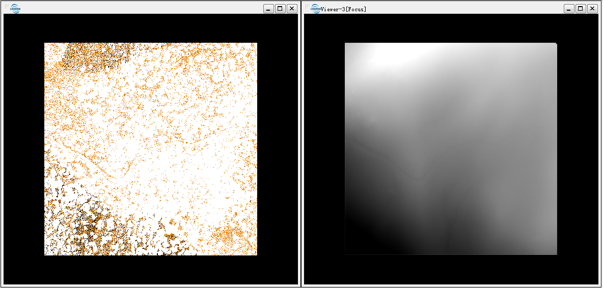
The original point cloud (left below) and the DEM(right below).
Note: Point clouds that are used to generate DEM need to contain ground points.