Tools
Usage
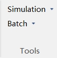
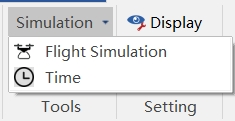
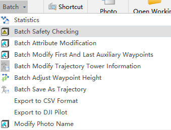
Tools mainly include Simulation and Batch. Simulation includes Flight Simulation and Flight Time; Batch includes Statistics, Batch Safety Checking, Batch Attribute Changing, Batch Modify First And Last Auxiliary Waypoints, Batch Modify Trajectory Tower Information, Batch Adjust Waypoint Height, Batch Save As Trajectory, Export to CSV Format, Export to DJI Pilot, Generate Track Line Point Cloud, Modify Photo Name.
Flight Simulation
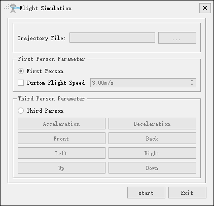
After loading the flight trajectory file, you can simulate the flight by selecting either the first-person or third-person perspective in the flight simulation.
Time
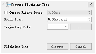
Flight time calculation needs to load the trajectory file, set the flight speed and waypoint dwell time, and get the total flight time of the UAV after executing the trajectory.
Statistics
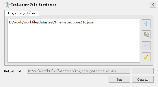
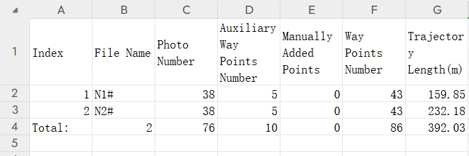
Statistics can export the parameter statistics table of the trajectory, click "Run" to generate a csv format file. The file is saved in the project folder. The statistical table mainly counts the number of photos of the trajectory, the number of auxiliary points, the number of manually added points and the number of waypoints, as shown in the figure below.
Batch Safety Checking
Batch safety checking mainly checks whether the trajectory files meet the safety requirements.
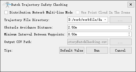
- Distribution Network Multi-line Mode: Not checked by default. When checked, set the root directory of distribution network lines. Automatically check the safety of trajectories in each branch directory.
- Use Point Cloud In The Scene: Not checked by default. When checked, use the point cloud in the scene for analysis. Otherwise, use the point cloud under the clipping data folder in each branch directory for analysis.
- Trajectory File Directory: Default fine inspection folder. In distribution network multi-line mode, select the line root directory.
- Obstacle Avoidance Distance: The default is the same as the inspection configuration.
- Minimum Interval Between Waypoints: The minimum safe distance between waypoints is 1.00m by default.
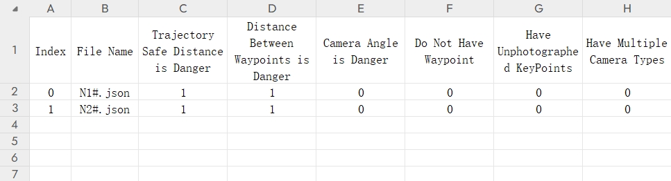
- Trajectory Safe Distance Is Danger: Safety distance is dangerous, obstacle avoidance distance does not meet the requirements.
- Distance Between Waypoints Is Danger: The distance between two adjacent waypoints is dangerous and does not meet the requirements.
- Camera Angle Is Danger: Camera angle is dangerous. The pitch angle of the camera point is positive.
- Do Not Have Waypoints: There are no waypoints.
- Have Unphotographed Key Points: Some part points are not photographed.
- Have Multiple Camera Types: The cameras used for taking photos on the same flight trajectory are not consistent.
Batch Attribute Changing
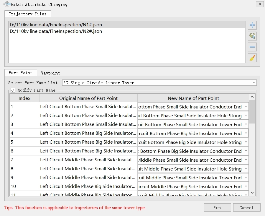
Batch attribute changing mainly includes key point change and waypoint change. Only the same tower type trajectories can be modified in batches.
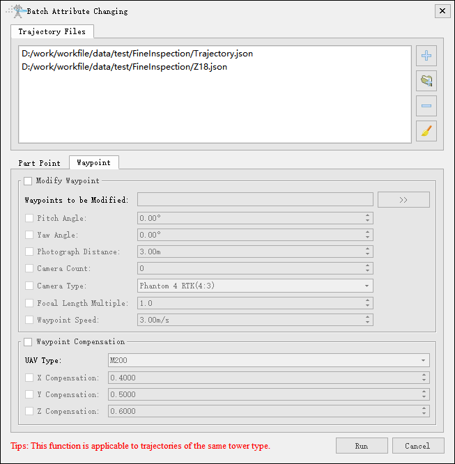
- Modify Waypoint:
- Waypoints to be Modified: Click the button on the right to add and select the waypoints that need to be modified. Typically, you would select all of them.
- Pitch Angle: The pitch angle of the waypoint, generally a negative value.
- Yaw Angle: The yaw angle of the waypoint.
- Photograph Distance: The distance at which photos are taken at the waypoint.
- Camera Count: The number of photos taken at the waypoint.
- Camera Type: Select the type of camera to be changed, a total of 14 types.
- Focal Length Multiple: For selectable zoom camera types, you can set the zoom factor, with a setting range of 0.1 to 12.0, and one decimal place to be preserved. For a fixed-focus camera type, this value cannot be set.
- Waypoint Speed: Flight speed at waypoints, with a setting range of 0.01 to 99.99, and two decimal places to be preserved.
- Waypoint Compensation: Check this option when converting drone trajectories for the M200 and M300 series.
- UAV Type: Customize.
- X Compensation: Default 0.4
- Y Compensation: Default 0.5
- Z Compensation: Default 0.6
Tip: This function is suitable for trajectories with the same tower type.
Batch Modify First And Last Auxiliary Waypoints
Batch modify the first and last auxiliary waypoints: the starting point points to the next waypoint, and the ending point points to the previous waypoint.
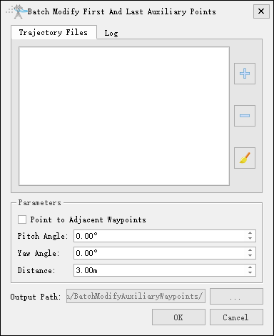
- Parameters
- Point to Adjacent Waypoints: Not checked by default; if checked, it will point to the adjacent waypoint.
- Pitch Angle: Set the pitch angle of the auxiliary waypoint.
- Yaw Angle: Set the yaw angle of the auxiliary point.
- Distance: Set the distance to the target point.
Batch Modify Trajectory Tower Information
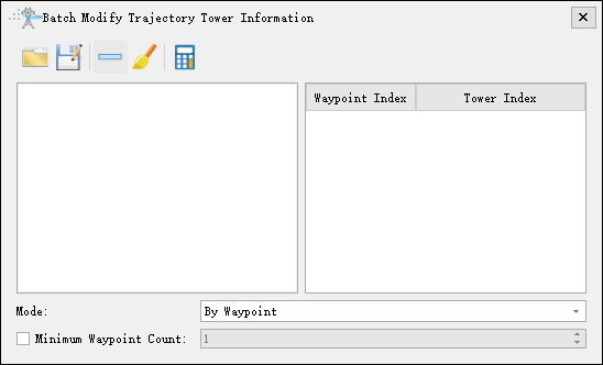
For multi-tower trajectories, calculate the tower index to which each waypoint belongs and modify the corresponding tower information, then save it as a new trajectory file, as shown in the figure below.
Batch Adjust Waypoint Height
Batch adjust waypoint altitude, supporting two modes: Move and Set Elevation.
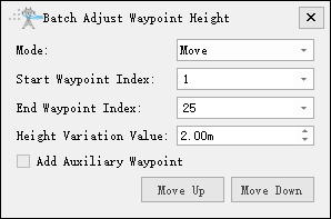
- Mode: Select the mode for settings, either Move or Set Elevation.
- Start Waypoint Index: Adjust the starting index of the waypoints.
- End Waypoint Index: Adjust the ending index of the waypoints.
- Height Variation Value(default "2.00m"): Set the height variation change value for moving waypoints.
- Add Auxiliary Waypoints: Not checked by default; if checked, auxiliary waypoints will be added automatically based on the adjustments.
Batch Save As Trajectory

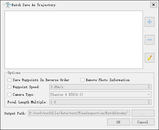
Batch Save As Trajectory supports saving waypoints in reverse order, removing photo information, using the original path, setting the emergency return point, setting waypoint speed, modifying camera type, etc., as shown in the figure below.
Export to CSV Format
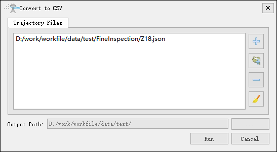
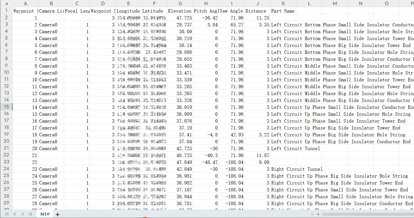
Export to CSV Format converts the trajectory file into a CSV format table file, which allows you to quickly view the parameters of each waypoint, as shown in the figure below. The file is saved in the project folder by default.
Export to DJI Pilot
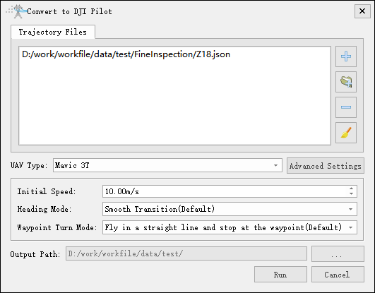
Convert to a drone trajectory compatible with the DJI Pilot app in KML or KMZ format. In advanced settings, you can set the yaw angle mode (1 Smooth transition; 2 Along the trajectory direction) and the waypoint turning mode (1 Fly in a straight line and stop at the waypoint; 2 Turn ahead and smoothly pass the waypoint).
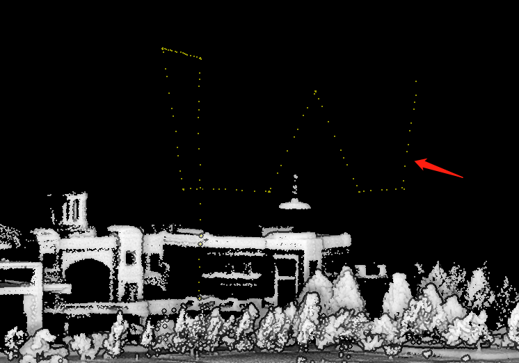
Generate Track Line Point Cloud
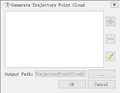
Add the .dat format trajectory file exported after the LiInspection app executes the trajectory. After running, a track line point cloud in .lidata format is generated. Add it to the software to view the flight trajectory of the trajectory.
Modify Photo Name
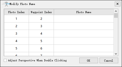
Batch modify photo names. Double-click to locate the waypoint. When "Adjust Perspective When Double Clicking" is checked, double-clicking will adjust the view to look at the photo point.